Italia – Lombardia
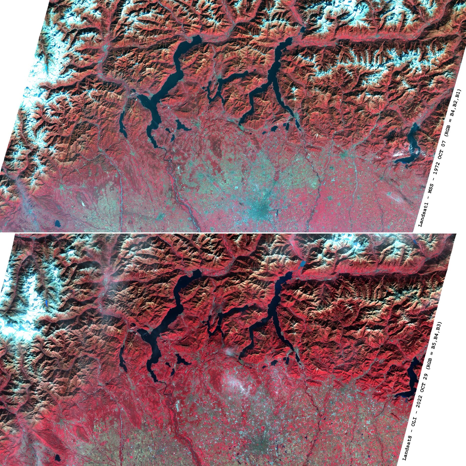
Immagini RGB della Lombardia: in rosso le aree vegetate, in bianco le aree innevate o coperte da nuvole, in verde le aree urbane o coltivate. L’immagine in alto è stata acquisita dal satellite NASA Landsat1-MSS (Multispectal Scanning System) il 7 Ottobre 1972, l’immagine in basso dal satellite NASA Landsat8-OLI (Operational Land Imager) dopo 50 anni, il 29 Ottobre 2022. Si osservi come le aree montane innevate delle prealpi Orobiche si siano notevolmente ridotte nel tempo e come si siano invece espanse le aree antropizzate nella fascia pedemontana e pianeggiante.
Italy – Lombardy RGB
RGB images of Lombardy region: vegetated areas in red, snow-covered or cloud-covered areas in white, urban or cultivated areas in green. The top image was acquired by NASA Landsat1-MSS (Multispectal Scanning System) on October 7, 1972, the bottom image by NASA Landsat8-OLI (Operational Land Imager) after 50 years, on October 29, 2022. It can be seen how the snow-covered mountain areas of the Orobic Pre-Alps have considerably reduced over time and how the entropized areas have instead expanded in the foothills and plains.
 using WordPress and